Showing posts with label track. Show all posts

Thursday, September 7, 2017

BOUDDI BIKING AND AVOCA BEACH - 5 SEPTEMBER 2017


This morning I drove to Bouddi National Park to ride the Turkey and North West Ridge tracks/trails.


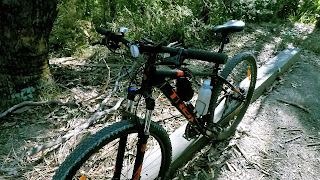
The new bike went so well. I attempted and went over bigger drop offs with ease, climbed the steeper sections quicker and rode smoother over roots and rocks. Overall, I felt more in control. Well, this all sounds like I'm building myself up for a big fall at some stage soon.


The ride was about 5km and I managed to finish it in about half the time it normally takes me. Hmm, I am heading for a fall.
Later, Kara, Mr Archibald and I had a sit down on Avoca Beach.


Mr Archibald attracted a lot of attention, as usual, and I was happy drinking my cappuccino while Kara did a lot of talking.

Saturday, July 2, 2016

SOMERSBY - OLD RAILWAY DAMS HIKE - 2 JULY 2016

I came here a short while ago but couldn't find the start of the track. I looked up an old map and compared to google maps. I found it and it was obscure.

First off, what a great hike!


It started with heaps of wildflowers and the sunrise peeking through the trees. The track was easy to follow but soon became difficult. Luckily, someone had left ribbons tied to trees to show the best way.


The track zigzagged down a cliff face which had a number of overhanging type caves.


At the base of the cliff, the soil was moist and ferns dominated amongst the trees.

Further on, the soil became saturated and the vegetation became thick, dense and lush and the ground was definitely a leech paradise. I found one later.


The first dam came suddenly into sight and a walk further along lead to the first dam wall. It was wide enough to walk across part of the way with care. It was a such a pretty place. I wandered around the dam wall and climbed down to its base.


I continued along the track and came to a pretty flat rock in the sun where the creek flowed across shallowly. I returned to this spot later for a rest and snack.


Further along the track, I came to the second dam wall. It was too steep and slippery to climb down and not far from the base was a drop off where I couldn't see the bottom. I wandered around but couldn't find a safe way down.


I climbed upwards to some nice rock overhangs and a huge flat rock area. From here, there were a number of other tracks which lead to dead ends.

The second dam itself was very pretty and tranquil.

I backtracked to leave.


A very adventurous 1.31km hike.

Friday, February 19, 2016

KINCUMBA MOUNTAIN - KANNING TRACK - HIKE - 17 FEBRUARY 2016


A cloudy morning with a peep of sunrise.


I ride around Kincumba Mountain a lot but when I originally started visiting the area I was mainly hiking. I'm not quite ready for a bike ride yet but I was very keen for a bush hike.


I chose the Kanning Track as it easy and has a lot to offer in a short hike.


Firstly, it was nice to meander along a track with natural bushland all around me. secondly, my walking speed was a bit slow and careful so I spent a lot of time looking at the smaller things - the texture of a tree's bark, the fronds of the ferns and rock shapes.


A few features of the walk was a large fallen tree at the beginning of the track. The root system of the base of the tree lined the edge of the path in a vertical direction.  Another large fallen tree on a sandstone rock platform looked like the base was sliced smoothly off the rock. Further along the track was a cave. Not very deep but deep enough to give easy protection from the elements.


A great hike.


Friday, December 5, 2014

CENTRAL COAST - BRISBANE WATER NP - ROCKY PONDS - MTB/HIKE - 3 december 2014

I parked at the speed camera in Woy Woy Road. It was an early start as it was predicted to be a hot day.


The ride started well along the service roads. The quarry is always a welcome watery break from the dry scenery. There are a number of pools in the quarry remains. On a previous ride, there was a group of girls swimming in the quarry pool. During a conversation, they informed me the water was nice and clean and that they had swam there a number of times.


Further along the ride, there were a number of steep and rocky descents. The second descent ended with a flat tyre. It took 10 minutes to change the tube. Later, I stopped at the top of one descent and admired the flowers along the edge of the service road and the hussle and bustle of the ant colonies.


Finally, I reached the turnoff for the track to Rocky Ponds. I rode for a short distance but found the going too hard with large water filled ditches. I put the bike into the bush and continued by foot.

It was a pleasant hike along a narrow, rough and vegetation clogged track. It had rain the night before so the bush was very damp. By the time I reached the start of the cascades, I was drenched.


The cascades were pretty and very slippery. The water flowed shallowly over the flat sandstone then fell over the drop to the next tier.

The highlight was Jeannies Pool. The water fell about 10 metres to the rocks then flowed into the pool. The pool is surrounded by thick vegetation and a concave cliff. The cliff dripped of water and could be walked under.


I put my wet gear on a sunny rock and waded into the water. The bottom of the pool was sand and gradually got deeper closer to the rocks at the base of the falls. It was a pretty sight and I enjoyed sitting on various rocks and soaking in the vista.

Not much in the way of birds toady... heard a lot but saw only a couple briefly. There were a few flowers about in various locations where they could get enough sun.

I did see a small lizard!


The journey back was harder. The hike section was hard due the damp bush and me now becoming the steamy bush and the steamy me. Once I was back on the bike, the temperature was quickly rising and there were a number of places where I had to push the bike due the service road steepness.

All in all, a great ride and now I'm a mite tired.

bike - 14.8 km
hike/swim - 1:14
bike - 1:25
av bike speed - 10.45 km/h
max bike speed - 33 km/h
Wednesday, April 23, 2014

CENTRAL COAST - BRISBANE WATER NP - KARIONG BROOK - MTB/HIKE - 20 april 2014

We parked at Staples Lookout and cycled down the Woy Woy Road for 100m to the first dirt service road on the right. There was parking there for about three cars.


We hauled the bikes over the gates and cycled down the service road. At one stage, there is relatively flat sandstone rock area with good views over the west.


At the junction for the great north walk track,  we locked the bikes to the sign and walked the track to Kariong Brook. The track was well worn and eroded in some places. Just before the brook, the steep section follows steps which go under an overhang.

The pool near the falls was very cold but so inviting for a swim. Dunking one's head under the waterfall seemed the right thing to do. The area around the falls is rainforest and nice to walk and scramble round.


We met a group of students here from Thailand and Malaysia. They were very polite and nice young people.We left the falls for the short but steep walk back to the bikes then the cycle back to Staples Lookout.


Funny, how the return always seems quicker even when going uphill.


distance - 5.54 km
time - 1 hour 12 minutes
elevation range - 178m


Thursday, July 7, 2011

CENTRAL COAST - Popran National Park – Mount Olive, Emerald Pool, Donovan’s Forest - HIKE - 5 July 2011


I set the GPS for Ironbark Road.  The road was labeled sealed and unsealed but the last 200 metres were 4w drive to national park car park.
The day was sunny but strong wind was predicted. The wind increased through the walk but it wasn’t a problem.

The planned walk entailed Mount Olive, Emerald pool and Donovan’s forest.

The walk started as a trail with a variety of wild flowers growing along the edges. The bottlebrushes were in full bloom in shades of red and yellow.
Turning off the trail, I followed the track to Mount Olive. It was an easy climb with a nice view over the national park.

Returning along the track, I followed the trail to the turnoff for Emerald Pool. This was fun track that ran beside a small creek that skirted to Hominy Creek. Hominy Creek had a flow of water running over sandstone. In parts it funneled, formed small pools or cascaded widely over the sandstone.


A track leads down 50 metres to Emerald Pool. It was a very pretty sight. The pool is a light green and deep. I thought about a swim but he water was icy cold. I sat down on a sunny slab of sandstone and enjoyed the serenity.

I backtracked a short distance, then followed the track to trail 248. At junction of the tracks I took the trail to the carpark via Donovan’s Forest. The forest in contrast with the surrounding area of open bush to a shaded forest that was floored with bracken fern that swayed in the breeze.

I continued along the trail to the carpark.

Thoughts

This walk would be better by cycling along the trails.

Wednesday, October 20, 2010

AUSTRALIA - QUEENSLAND - O'Reillys Rainforest Resort and Morans Falls - HIKE - October 2010

O'Reilly's Rainforest Resort and Moran Falls are in the Lamington National Park, Queensland.

O'Reilly's has an excellent walk through the rainforest and gardens. The walk through the rainforest is on platforms which rise into the tree canopy. At one point there is a tree ladder which takes you to the top of a huge tree and a great view of the surrounding forest and valley and the scenery below.

The walk branches off into a created garden with a variety of signposted plants.


Morans Falls is a two hour walk starting about a kilometre from O'Reillys. The track is easy through rainforest which becomes denser near the falls. The view of the falls is excellent and continuing onwards the track leads over the creek that feeds the falls and onwards further leads to valley views on the other side of the falls. It is also easy to follow the flat rocks lining the creek.

While photographing the canopy above me, i didn't notice the snake coiled on the path. luckily, i did before i stepped on it. I jumped back like a ninja to avoid it. Still, it was interesting and i observed the snake for quite a while before it slid off.

Sunday, November 15, 2009

AUSTRALIA - Hawks Nest - Yacaaba Heads base - HIKE - January 2009

Walk along Hawkes Nest Beach to the southern end to reach Yacaaba Heads.

The walk starts off easy with a track leading over the rocky base of the headland. A few small beaches are passed along the way until the path ends and the rocks become huge and cliff edge of the headland dominates.

Now the walk becomes a scramble and climb over and under rocks and edging along the cliff edge. At times, the only way to pass is high and at others it is close to the water line. There were also parts where you had to hang upside down to lower yourself to the level below. Hard but fun.

Eventually, the way becomes impassable either high or low without becoming dangerous due to deep crevasses in the sheer cliff face.

Time: 3 hours


CENTRAL COAST - 4 TO 11 MARCH 2023

 4 MARCH I woke and unloaded and tidied the van. I drove Jacinta to the Hens party for Chloe at Glenworth Valley. Back home and I tidi...